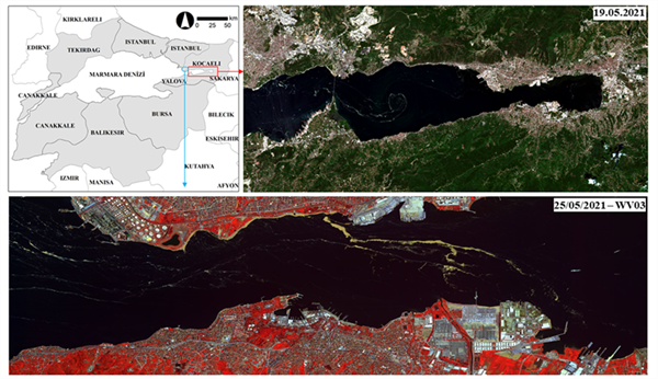
Within the scope of the project, the Marmara Sea will be examined within the natural basin boundary, using high-resolution satellite images downloaded at the time of mucilage and freely accessible satellite images under the ITU UHUZAM. For this purpose, the natural basin boundary for the Marmara Sea will be delineated with an interdisciplinary team. In parallel with the land cover/land use (LC/LU) change in the determined basin in the study, the land-sea interaction will be examined, mucilage-covered areas will be determined from satellite images and the relationship and spread of these areas will be examined with bathymetry and current directions. Thus, a feasible monitoring and control infrastructure model (mechanism) will be developed when a possible future mucilage threat will be experienced.
Within the scope of the project, the Marmara Sea will be examined within the natural basin boundary, using high-resolution satellite images downloaded at the time of mucilage and freely accessible satellite images under the ITU UHUZAM. For this purpose, the natural basin boundary for the Marmara Sea will be delineated with an interdisciplinary team. In parallel with the land cover/land use (LC/LU) change in the determined basin in the study, the land-sea interaction will be examined, mucilage-covered areas will be determined from satellite images and the relationship and spread of these areas will be examined with bathymetry and current directions. Thus, a feasible monitoring and control infrastructure model (mechanism) will be developed when a possible future mucilage threat will be experienced.
You can find the detailed explanation about the project, coordinated by Prof. Dr. Nebiye Musaoğlu, below.

Project Title: Establishing the Infrastructure of the Pollution Monitoring System Specific to the Sea of Marmara by Using Information Technologies
Project Number: 121G142-TÜBİTAK 1001
Project Coordinator: Prof. Dr. Nebiye Musaoğlu
Abstract: The mucilage recently seen in the Marmara Sea leading to significant environmental problems has clearly caused the deterioration of the marine ecosystem. It will be possible to investigate the reasons of mucilage formation, to determine the change that occurs over time when mucilage is seen, to take precautions on time by developing an infrastructure model ready to use that includes as many parameters as possible. Satellite images are an important data source as they enable high accuracy results to be produced in a short time. In addition to determining the areas under the influence of mucilage from satellite images, the distribution on the sea surface, the changes in the sea water surface temperature, suspended solids, the secchi disc depth and chlorophyll-a that may affect the formation of the mucilage, and the land cover that may affect the sea on the land cover/land use changes can also be determined. Satellite images will be correlated with the marine measurements made by Istanbul University during the periods when mucilage was present in the Marmara Sea, and the changes in the structure and characterization of the mucilage will be revealed. Examination of the Marmara Sea alone is important in terms of revealing the problem and suggesting solutions. However, determining the natural basin boundaries affecting the Marmara Sea and revealing the land-sea interaction will allow the results of the study to contribute more to the solution of the problem. Within the scope of the project, the Marmara Sea will be examined within the natural basin boundary, using high-resolution satellite images downloaded at the time of mucilage and freely accessible satellite images under the ITU UHUZAM. For this purpose, the natural basin boundary for the Marmara Sea will be delineated with an interdisciplinary team. In parallel with the LC/LU change in the determined basin in the study, the land-sea interaction will be examined, mucilage-covered areas will be determined from satellite images and the relationship and spread of these areas will be examined with bathymetry and current directions. Thus, a feasible monitoring and control infrastructure model (mechanism) will be developed when a possible future mucilage threat will be experienced.