Project Title: Monitoring the Troposphere and Snow Depth/Thickness in Antarctic Region Based On GNSS Meteorology and GNSS-Reflectometry Methods
Project Type: TÜBİTAK Project
Project Coordinator: Dr. Mahmut Oğuz Selbesoğlu
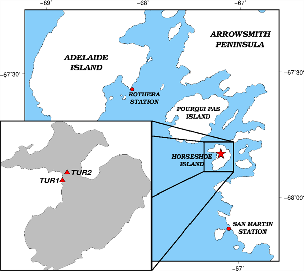
In recent years, advanced remote sensing technologies based on space geodetic techniques has become an effective supporting tool for monitoring global climate change by important parameters such as atmospheric water vapor, sea, ice and snow levels. In this context, GNSS Meteorology and GNSS Reflectometry techniques evolved based on satellite navigation signals are widely used for monitoring the Earth's surface and atmosphere characteristics. The main purpose of the project is observing meteorological and physical parameters such as water vapor in the atmosphere and ice/sea level changes in the Horseshoe Island, Antarctica to contribute climate change monitoring. For this purpose, within the scope of Turkey's 4th National Antarctic Science Expedition (TAE-4), Turkey's Antarctic permanent GNSS (Global Navigation Satellite System) stations (TUR1 & TUR2) were installed on Horseshoe Island. TUR1 and TUR2 GNSS stations, installed within the scope of TUBITAK Project No. 118Y322, have been continuously collecting data from GPS, GLONASS, GALILEO and BEIDOU Satellite Systems since February 24, 2020. The expected results will be an important source of data for understanding and predicting local and global change, as well as contributing to understanding climate change and its evolution over time.

